12 Traffic information
12
}}
75
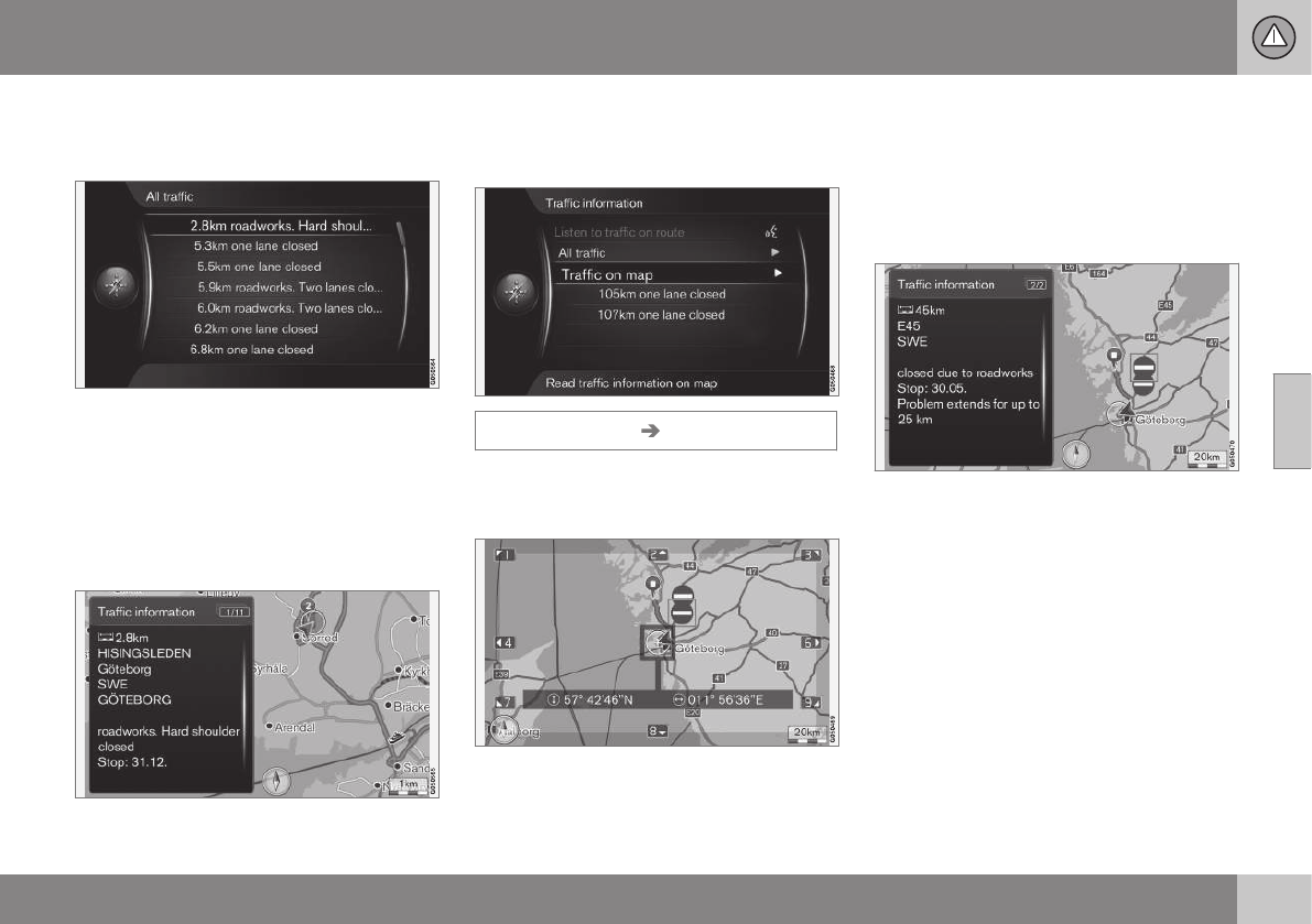
Cursor on a road/street + OK gives specific
traffic information highlighted road/street -
see next figure:
Specific traffic information.
Traffic information for a specific road/street is
listed according to the criterion of most seri-
ous disruption at the top, e.g. total stop in a
lane.
Cursor on a traffic problem + OK shows fur-
ther information and position on map - see
next figure:
Traffic problem on map.
The map image is centred around the posi-
tion of the traffic problem.
Traffic information on map
Traffic information Traffic on map
Cursor on Traffic on map + OK enables the
option to search for traffic problems with the
scroll function (p. 36).
Use the scroll function to show information
about a specific traffic problem.
1. Scroll the crosshair to the traffic event/
symbol about which detailed information
is required - a yellow frame illuminates
around the symbol.
2. Press OK - after which, information is
shown similar to that in the following fig-
ure:
Information about a traffic problem is tied to
each respective symbol, and depending on
the extent to which details are available the
following may, for example, be shown:
•
street name/road number
•
country
•
nature of the problem
•
extent of the problem
•
duration of the problem.
If there are several traffic problems within the
crosshair frame then the one closest to the
centre of the crosshair is shown first.
Figures such as "
2/5" in the upper part of the
screen mean that the information shown is

