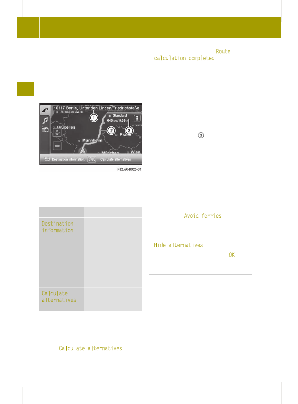
The map shows:
R
the destination address (at the top)
R
the route as a blue line
R
the selected route option (e.g.
standard) with the distance and
estimated journey duration to the
destination
Map after route calculation (Expert mode)
:
Address entered
;
Route calculated (light blue)
=
Selected route option
Selection Function
Destination
information
Calls up the detailed
information menu.
X
Store the city as a
favorite or as the
home address
(Y page 36).
X
Check/change the
route options
(Y page 37).
Calculate
alternatives
(Expert mode)
Calculates two
additional
alternative routes.
Calculating alternative routes
Audio system navigation/multimedia
calculates two alternative routes in Expert
mode (e.g. short, fast).
X
Press Calculate alternatives
.
The alternative routes are calculated.
After the alternative routes have been
calculated, you will hear Route
calculation completed.
The map shows the following routes on the
right:
R
standard (light blue)
R
alternative 1(green)
R
alternative 2 (light brown)
Each route is shown with the distance and
estimated journey time to the
destination.
X
To view information about route/
alternative route =
: press ã.
You see the following information:
R
length (distance)
R
journey time (estimated)
R
arrival time (estimated)
R
highways (length of the route used)
R
toll roads (length of the route used)
R
ferries (length of the route used)
X
Press & to close the display.
i
The ã symbolis shown in red if a route
option (e.g. Avoid ferries) that has
been selected for the route does not make
sense. Set the route options (Y page 33).
X
To hide the alternative routes: press
Hide alternatives.
X
To start route guidance: press OK.
Entering a ZIP code
X
Press the entry with the zip code in the
"Entering a new destination" menu
(Y page 34).
The input menu for the zip code appears.
38
Destination input
>> Navigation.

